Raleigh-based Surveyor Puts Ayres on the Map in North Carolina
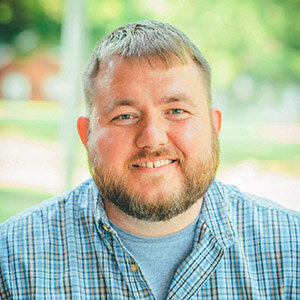 Joey Fuller, PLS, recently joined Ayres’ survey staff with experience in boundary, topographic, and control surveying and construction staking. As a professional land surveyor licensed and based in North Carolina, Fuller’s hiring advances Ayres’ commitment to providing survey and aerial mapping services to the state. He has provided professional survey and CADD services for a decade.
Located in Raleigh, Fuller anchors and mentors our North Carolina geospatial staff, manages projects, and performs quality assurance/quality control (QA/QC). He is a problem solver who has managed field crews and CADD personnel and is known for ensuring quality deliverables and minimizing scope creep.
“We’re very excited to be offering North Carolina-based survey services, and Joey is such a great fit with our hard-working, highly trained staff,” says Jason Krueger, CP, GISP, vice president of geospatial services. “There’s a lot of work waiting for us here. With Joey, we plan to go out and earn it.”
Fuller works on transportation, utility, municipal, environmental and site development design surveys; geospatial control and lidar QA/QC; and land surveys including ALTA, CSM, subdivision plats, and Department of Transportation (DOT) right-of-way plats.
Since April 2022, Ayres has engaged over 30 members of its Geospatial Division in providing survey, construction staking, and unmanned aerial systems (UAS) services as a subconsultant under Ames Construction in support of the North Carolina DOT’s Greensboro-Randolph Megasite project, logging over 6,300 hours on the project in and around the future Toyota battery plant site.
“As we continue to do work for Ames on the Toyota battery plant, I believe our quality of work and punctuality in deliverables will afford us many more opportunities,” Fuller says, adding that he plans to pursue a balance of municipal and private sector work to establish a sustainable future in North Carolina, where he sees the opportunities as plentiful and the sky as the limit.
“So far, this opportunity has been both rewarding and challenging,” Fuller says. “I have always had a desire to build a team of my own, and joining with Ayres to help establish our presence in North Carolina is fulfilling that desire. The people I have worked with so far have been fantastic and supportive in moving forward with staffing and professional support.”
Operating in North Carolina as Ayres Engineering Inc., Ayres hopes to offer additional services in North Carolina soon. Ayres’ Geospatial Division already offers a diverse array of services in the fields of land survey, GIS, aerial mapping, remote sensing, and unmanned aerial systems.