Inside Ayres
See the latest in Ayres and industry news.

Derringer Re-elected Wisconsin Land Information Council Chair
July 2, 2019
Adam Derringer, GISP, a senior project manager in our aerial mapping group, was recently re-appointed to a three-year term on the Wisconsin Land Information Council and re-elected as its chairman. The Wisconsin Land Information Council serves an advisory role to the Wisconsin Department of Administration on matters relating to the Wisconsin Land Information Program. Members… Read More »

Ayres Wins National Award for Creative Bridge Project
May 15, 2019
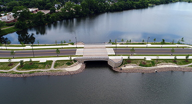
The American Public Works Association has selected the Grand Avenue Half Moon Lake Bridge in Eau Claire, Wisconsin, as one of its 2019 Public Works Projects of the Year in the Small Cities/Rural Communities Transportation category. This national award comes on the heels of the APWA Wisconsin Chapter’s 2019 Project of the Year Award, the… Read More »

WLIA Recognizes Derringer for Outstanding Contribution
April 4, 2019
The Wisconsin Land Information Association has awarded its 2019 Outstanding Contribution Award to Adam Derringer, GISP. Derringer is a project manager in our aerial mapping group. The Outstanding Contribution Award is given to an individual or organization that has made a substantial contribution to WLIA activities or the Wisconsin Land Information Program. Derringer has been… Read More »

Ayres’ Nienow Re-elected to WLIA Board of Directors
February 22, 2019
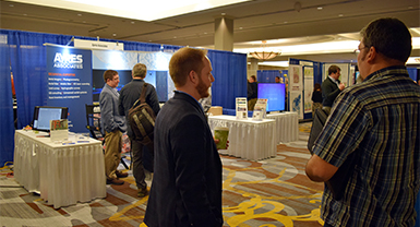
Zachary Nienow, GISP, project manager in Ayres Associates’ aerial mapping group, was re-elected to the Wisconsin Land Information Association’s Board of Directors. An announcement was made today at WLIA’s annual conference in Appleton. With nearly 15 years of experience in geospatial sciences, Nienow designs and leads lidar, orthoimagery, and digital mapping projects from flight to… Read More »

Wisconsin Completes Statewide Lidar Coverage
Wisconsin lidar stakeholders celebrated the completion of statewide lidar, convening for cake and refreshments Thursday afternoon at the Wisconsin Land Information Association (WLIA) annual conference. APPLETON, Wis. – For the first time lidar coverage is now available across the entire state of Wisconsin, offering users highly accurate elevation data for critical applications such as floodplain… Read More »
