What is an ALTA Survey?

ALTA, otherwise known as the American Land Title Association, is a national development aimed at improving the skills and knowledge of providers of real property. Members of ALTA are responsible for reviewing, researching, and insuring land titles to protect their owners. Ayres stands to benefit from the association utilizing ALTA surveys. In this blog post, we will explain the basics of an ALTA survey, how an ALTA survey is conducted, and why ALTA surveys are an essential method of comprehensive property investigation.
About the Expert:
Brett Karns, a professional land surveyor since 2008 and retired engineer officer, has extensive experience in ALTA surveys, topographic surveys, subdivision maps, parcel maps, and construction staking. He excels in project management, business development, and mentoring junior staff. Brett efficiently manages survey crews, coordinates with utilities, and ensures timely, budget-compliant project delivery. He conducts preliminary surveys, prepares related documents, and uses Civil 3D for surface creation and layout calculations.
What are the basics of an ALTA Survey and what is the process?
An ALTA survey is an exclusive Boundary survey dedicated to adhering to the standards of the American Land Title Association. An essential part of land ownership is professionally delineating the property’s boundaries. Defining a property’s boundaries not only prevents any dispute on a premises but is also an essential component of receiving comprehensive Title Insurance. This form of legitimate property insurance protects the owner, and lender, from legal financial disputes that could occur with the property. The reason this survey plays a significant role with insurance is because if an incident were to happen on a property with imprecise property lines, it would not be covered. For this to be prevented, ALTA surveys ensure boundaries are recorded by a professional surveyor. There are three main components consisting of an ALTA Survey that are required to follow the Minimum Standard Detail Requirements:
Stage One: Before the physical survey can take place, research on the land parcel must be conducted. Historical documents contained on public and private roads are gathered to uncover any information about the property. However, some of these documents can be decades old, and impossible to scrutinize. Occasionally, the professional surveyor can retrace the steps the original surveyor took when the acreage was first established.
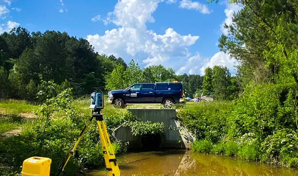
Stage Two: Once all historical documents have been thoroughly investigated, the physical survey can be delineated. “Corners,” otherwise known as “monuments,” include the physical points where boundary lines intersect, or at any other point along a property line. These markers usually incorporate a steel pin nailed into the ground containing a flat disc displaying the land surveyor’s name and professional license number. Monuments are typically placed on a property’s exact corner. However, if this is not possible, they can be positioned as close as physically possible, in which they will be labeled as a “reference monument.” A reference monument will not portray its exact location as being a property’s corner but will describe the relationship between the marker and the actual location of the corner. An aspect that aids in the procedure is the use of “accessories,” or objects that are easily identified. Examples of accessories can be land features such as rocks, trees, or even manufactured objects such as statues, poles, and fences.
Stage Three: Once all historical documents have been thoroughly investigated and correct property boundaries have been physically identified, the final stage of the ALTA survey can be conducted; preparing the plat/map. Computer-aided drafting, otherwise known as CAD, creates a visual assessment of property boundaries and features of the property. CAD successfully identifies buildings and geographical features that exist on the land, while also including technical identifications of easements between properties. All information put out from CAD must be organized consistently with ALTA standards.
Why do ALTA Surveys Matter?
ALTA surveys are a necessary and valuable tool for commercial real estate properties. It ensures buyers and lenders have all the information needed to produce transactions. Without an ALTA survey, buyers could be at risk of purchasing acreage with unknown liability or limitations. Granted, these surveys come with an excessive cost, but having the insurance of discovering potential issues with the property is much less expensive than having to deal with them later. Typically, higher costs tend to be associated with larger properties with more acres to cover. ALTA surveys can also take several weeks or even
months to complete. The timeline can be affected by several factors including access restrictions, weather conditions, or other issues discovered in the research and development phase reports.
ALTA surveys may contain a high price tag as well as an extensive timeline but remain an essential key in comprehensive property investigation. An ALTA survey is required for anyone wanting to know their land’s true boundaries and limitations on potential use.
For questions or more information regarding ALTA surveys, contact Ayres’ Brett Karns.

Post a comment: