WLIA Tunes In to Today’s Geospatial Technology
 Customized orthophotography is a complex and complicated concept that probably wouldn’t mean much to the average person – but the methods in which it’s ultimately used are mind-blowing. The same can be said for lidar, HD laser scanning, and more. Volumetric calculations, impervious surface calculations, change detection, culvert extraction, 3-D urban modeling: the sky’s the limit in terms of ways in which the data that can be derived and the applications for which it can be used. Just ask any municipality, county, state agency, tribal organization, or utility company.
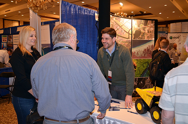
Last week more than 375 land information professionals, GIS specialists, mapping experts, and others convened at the Wisconsin Land Information Association’s 29th annual conference. Held at the Osthoff Resort in Elkhart Lake, the conference featured compelling speakers, engaging exhibits, enlightening educational sessions, and an assortment of informational technical workshops – all with the end goal of promoting innovative ideas and advancing various aspects of the field.
WLIA is a critically important grass-roots organization representing a diverse collection of professionals dedicated to developing, maintaining, and applying a network of statewide land information systems.
Ayres Associates – a proud WLIA member, platinum sponsor, and one of 30 exhibitors at the annual conference – shared insights on two timely lidar-focused topics during the event, “Lidar Standards and Specifications in Wisconsin,” presented by Zach Nienow, and “Lidar and Imagery Derivative Products for Municipal Applications,” led by Adam Derringer and Mike Seidel.
Zach’s presentation focused on the recent changes to the standards commonly referenced in Wisconsin lidar projects. When preparing for upcoming lidar projects for municipal or countywide projects, it’s important to understand the implications of the various standards and specifications in use today – and how they can impact your project. Zach highlighted the basic standards for the U.S. Geological Survey 3DEP program, American Society for Photogrammetry and Remote Sensing (ASPRS), and Federal Emergency Management Agency (FEMA) and how the standards are being applied in Wisconsin.
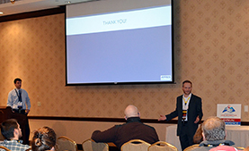 Adam and Mike’s presentation centered on specialized mapping applications to support a wide range of municipal services, including engineering, planning, zoning, change detection, 3-D modeling, urban forestry, public works, and public safety. The two explained in detail the additional base mapping data, as well as analytical products beyond topography and orthoimagery that can be extracted from an aerial photography mission, opening the audience’s eyes to what can be done with such data.
Zach and Adam would welcome the opportunity to provide additional details about their presentations, WLIA, or the industry in general. Contact them at NienowZ@AyresAssociates.com and DerringerA@AyresAssociates.com.
A host of other sessions took place last week, including several special interest groups – among them Cartography for Professionals, lidar, Open Source, Women in GIS, and Municipal GIS. Read more here.
And mark your calendars for the next WLIA annual conference at Chula Vista in Wisconsin Dells Feb. 22-24, 2017!
Post a comment: